Tuesday, October 12, 2010

A visit from Family

I had a great visit from my niece Julie, her daughter Idarah and our family friend Greg, Jr. The first evening, we grabbed some yummy sandwiches from the local market and went up to Calaveras-Bigtrees State Park. We drove through the park and looked around, then returned to the main grove of Giant Sequoias.
Idarah was very happy to be wandering on the trails, just like the rest of us.


Yep, she's getting bigger but, so is this "bigtree".


Idarah does the cutest things. She's such a good baby, just like her mama was!


The next day, we all went to Yosemite. I figured Glacier Point might be less crowded, and provide a more awesome view for Greg, who had never been to Yosemite before. We had lunch with a view of Half Dome and the high Sierra Nevada. Here's the view of the valley floor, looking over the edge of Glacier Point.


We descended back into the valley and decided to stop off at Bridalveil Falls, which was still running. Yosemite Falls was merely a trickle so, this was our best bet to see a waterfall up close. Winds always affect Bridalveil, and that day was no exception.


Labels: , , , ,

Sunday, February 21, 2010

Wildfire Effects

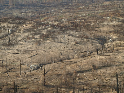
While in Yosemite this past week, I got my first look at the area where Park Service fire people lost their controlled burn project within an hour of starting it. They were late getting started and the winds turned from downslope to upslope during the morning of a near-record high temperature summer day. The embers flew out of the fires they set and landed in the snags left over from the 1989 A-Rock Fire, which I was involved with salvaging dead timber on. Since this part of the fire is in Yosemite National Park, no post-fire salvaging could be done and all of the old growth that perished in the first fire became fuel for the next fire 20 years down the road.
As you can clearly see, the re-burn incinerated everything that had grown back in 20 years time. In many spots in this picture, ALL organic matter in the soils has been vaporized. The tremendous heat, estimated at up to 1342 degrees F, depletes the soil of nutrients up to three feet down. This fire burned 17,000 acres (26 square miles!) and cost $15,000,000 to put out. The original acreage of the controlled burn was supposed to be 90 acres. Take a look at this "moonscape".


A view of the upper slopes also shows the utter devastation from an intense wildfire burning in concentrated dry fuels. This used to be an old growth pine stand, with trees that had survived countless wildfires in the last 500 years, or more!

There are those in this country who would have you believe that these fires are "natural and beneficial", or "an integral part of our forest ecosystems". These ideas are a part of a failing paradigm that thinks our forests evolved without human influence and "management". There is amazing evidence that Indians had major impacts over their environment, enhancing their survival and prosperity. They burned vast areas to promote their favorite "crops", like acorns, berries and corn. Historical accounts and even sketches prove that much of the coastal mountains of Oregon were devoid of conifer trees, and that the oak savannas created by Indians burning were the dominant features of the landscape. Today, almost all of those areas have turned back to conifers, and the big forest fires that follow them, like the Biscuit Fire.
Today's high-intensity wildfires are far from being "natural and beneficial", especially when they destroy forests, causing catastrophic erosion, and reach private property. The costs of fire suppression is very high but, the post-fire impacts cost up to ten times more than the original fire. You've seen the mudslides in Los Angeles from the Station Fire. Those will continue to happen for many years into the future because the soils are "melted", with a layer of hydrophobicity, which doesn't allow water to penetrate in the ground.
I'm currently battling several "preservationists", who embrace these kinds of fires. Posting these pictures here will allow me to show others the actual impacts of high intensity wildfires.

Labels: , , , ,

Tuesday, January 12, 2010

Fake photos?

While some "purists" demean Photoshop-enhanced photos, I contend that it is just another form of "art". Do non-fiction writers accused novelists of "faking it"? In the end, you either like it, or you don't like it, just like any other art form.
.
This original picture was both blessed and cursed at the same time. I actually didn't see anything through the lens, looking into the mid-morning sun. I didn't even know that the buck had stopped running to see what made that strange noise. He even posed for me with his best studly look. I think it still needs a little tweaking to bring out the deer somehow, as he almost blends into the background.


This photo I took of the "Diving Board", near Yosemite's Half Dome, was also flawed from the start. Shooting into the afternoon sun was going to be a problem but, I just had to capture the drama and impact of this amazing 3000 foot cliff. Ansel Adams once climbed all the way up here to take one of his most famous Half Dome pictures. I'm guessing that this picture will look pretty amateurish in a week or two. I will get better and better as I learn how to use the right tools in Photoshop.


Labels: , , , ,

Sunday, August 23, 2009

Sentinel Rock and Glacier Point

I took yet another trip to smoky Yosemite and my destination was Sentinel Rock. I have been atop Sentinel Dome twice in the past so, I just walked on by it on my way to the edge of Yosemite Valley. I had a vague idea that Sentinel Rock wasn't very easy to get to but, I wanted to check out that rugged part of the Park for myself. When I wandered off the trail, I found that there was a 15 foot wall blocking my access and there was no way to safely drop off. I looked and looked and there was a potential way of getting there but that would involve a similarly dangerous "long way around".
So, I cut my losses and snapped off as many pics as i wanted and planned my Plan B. Right here is a picture of the farthest I could get, standing on a cliff, looking towards the massive El Capitan.


I spied this snag growing on the edge of the rugged cliff of Sentinel Rock so, I took out my telephoto lens and zoomed into the snag with El Capitan as a background.


I was hoping that Yosemite Falls would still have a pretty good flow, with Sentinal Rock being just right across the valley. The early snowmelt has drained the watershed of fresh springwater and it now is a scant trickle, as you can see. This is a quite different view of the famous Upper Falls and part of the very interesting inner gorge.


Here is a distant view of North Dome and Basket Dome, pulled in with my telephoto lens. Years ago, I took a hike and visited the top of both of them. Very few people go there, with the 10 mile roundtrip from the Tioga Pass Road.


Walking back via the trail, I had this nice view of Half Dome. Zooming into this shot, using Photoshop, I could see individual people on top of this Yosemite icon. Clouds Rest looms behind Half Dome and the peak has, arguably, the best view in all of Yosemite. I was once there and took pictures but, the roll of film somehow disappeared. Maybe I'll make it back up there, one day.


Labels: , , , ,

Tuesday, January 27, 2009

Ribbon Falls video

Here is North America's tallest single waterfall during the peak of the spring runoff a few years ago. I'd like to hike up to the base of the falls this spring and see what I can capture.

Labels: ,

Monday, February 04, 2008

Scan-O-Mania!

Here's a picture that I was able to "recover", using the digital photo tools I have at my disposal. This Kodachrome slide was way underexposed and was completely unusable. I adjusted the scan controls and played with all the enhancement settings and came up with this very nice photo from my snow camping trip on Glacier Point back in the 90's.


Here's another nice reflection shot that was uncropped from the original slide. This was my attempt at "fine art" but, I've found better examples in some of the other Grant Lake photos. I know that my "eye" is more tuned and more experienced now and I'm enjoying the rediscovery of my old pictures.


This next shot was from a Backcountry Ski Club trip to the Bishop Pass area of Kings Canyon National Park. This is true wilderness, where man only comes as a visitor and Mother Nature has no problem in telling you when it's time to leave. This National Park is as rugged and remote as any other in America. Not many humans have ever been to this spot!


During a drought winter, back in the early 90's, I wandered up the Yosemite Falls trail and did a little off-trail exploring in the area between the Upper and Lower Yosemite Falls. I love the browns and the textures of the rocks. Someday I'll get down into that "inner gorge".


Finally, we have yet another Grant Lake picture. I'm not completely happy with how the scan came out. The picture lost some of that great "golden hour" light that was in the original Kodachrome slide. This picture also seems to have great opportunities for cropping out some more great pics.


Labels: , , , , ,

Sunday, January 20, 2008

Son of New Scans!

I've been VERY busy in scanning some of my very best Kodachrome slides for inclusion into my Yosemite portfolio book project. I spent the last two days searching through my files, slide boxes and even the loose slides gathering dust in slide projector carousel boxes. You don't quite yet get to see the best of those because I had these others ready to go first.
.
Yosemite's Budd Lake is in the High Sierra and nestled right at the base of the awe-inspiring Cathedral Peak. I fully intend to spend the night there and capture the beauty of the "Golden Hours". This is a perfect example of a "cirque lake", where a glacier had "ground its heel" and scooped out a depression then melted and formed a lake.
.

While I do have successes in scanning, like the above shot, I also need more practice in using Photoshop Elements and the Nikon Scan programs. It's definitely an interesting task to revisit old places and recapture the scenes better than you did 20 years ago. This picture below lost a little bit of that warm yellow evening light that is in the original slide.

Here's another tough photo to manipulate. These contrasty scenes, like Upper Yosemite Falls, always fooled my camera and I into under-exposing the darker areas. Snow and white granite reflect more light and the camera sensors automatically adjust for those bright highlights. Ideally, one has to go into manual exposure mode and over-expose those bright features so the the blues and greens aren't so unnaturally dark.

Here's a "properly worshipful" view of Giant Sequoias that I didn't have to "fiddle" with to get it to look right. What is really interesting about these groves is that trees of other species often reach their maximum sizes in futile competition with the beastly Giant Sequioas.

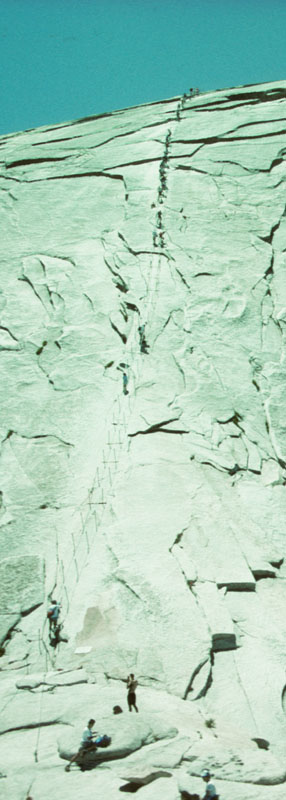
This slide came out quite well, as I used the Levels controls and set the white balance by clicking on the climbers white shirt. Suddenly, the greens were enhanced and the blue sky looked more realistic, instead of like deep space. In the high-res scan, you can zoom in on those dozen or so people at the bottom of Half Dome's cable ladder. On the descent, my polarizing filter popped out of my cracked Tokina lens and bounced at least 80 feet to the bottom of the cable ladder. Except for a dent in the outer ring, the glass filter was undamaged.

Labels: , ,

Thursday, January 10, 2008

New Yosemite scans!

To flesh out my new Mpix ( http://www.mpix.com/ ) book to use as a Yosemite portfolio, I scanned these old Kodachrome slides recently. It's really cool to be able to go back to those trips and, basically, re-compose many of those old shots.
This one below came out pretty well, without too much scanning trouble. I didn't crop this one of Yosemite's Natural Arch.


I was intrigued whether I could crop and improve on this interesting "rainbow" shot of Yosemite Falls from Glacier Point. I still need to be more skilled at sharpening these kinds of pictures without overdoing it. It just might work better as a black and white photo.


This shot, from Stanford Point on a skiing trip, took a lot of fiddling and I'm still not satisfied with the results. I was able to tone down a bluish cast and do some sharpening but, I'd be happy if the picture looked exactly like the original. More practice is needed to sort through all the jam-packed features of my Nikon scanner.


On the other hand, this pic came out looking almost exactly like the original. I still think this pic also has a bluish cast and could benefit from greener greens. I love the glacial polish and juniper trees are one of my few favorites. The Grand Canyon of the Tuolumne is a deep V-shaped canyon that was home to the Sierra Nevada's longest glacier, over 40 miles long at its largest during the Ice Ages.


I stumbled across this slide and looked for a way to crop a great picture out of the original. That afternoon and early evening had terrific light and Grant Lake was obviously perfectly glassy.


Labels: , , , , , ,

Monday, July 23, 2007

A Night in the Park

I had a lot of time off before my next assignment and almost wasted my chance to get up to Yosemite and get some more pictures of my favorite place on this planet. (I'm sure there's bigger canyons and more colorful places on other planets.)

I picked a place that I had been to before, many years ago with my friend Euell. And, true to form, that day was amazing for taking pictures. This time was no diffeent, either. I wanted to be on top of the very easy Mount Watkins by mid-afternoon. Accessible from the Tioga Pass Road (Highway 120), Mount Watkins is an easy 2 mile hike from Olmstead Point, the famous overlook that everyone stops at on their way up to the high country and Tuolumne Meadows. Being right across Tenaya Canyon from Cloud's Rest and Half Dome, Mount Watkins offers close-up views like nowhere else in Yosemite. As you can see in this picture below, the view of Half Dome is much different than you're used to seeing. Somehow, I think it looks much more impressive from this direction.


I always marvel at the smooth glacial-polished granite near the Quarter Domes and Cloud's Rest. A huge glacier once came down Tenaya Canyon and scoured it clean of any soil that was once here, millions of years ago. The combination of ice and sand will, literally, polish the rock very smooth. In this picture, I like the diagonal ledges and the smooth granite. Might be an adventure to explore (with ropes, of course!).


This peak was discovered by the famous mountain explorer, and Federal employee, Clarence King. He was one of the first explorers in the Sierra Nevada, braving the wilds of the times and risking death at every turn. Look for his book someday, written in something like 1873 (I can't remember the title). King named this peak "The Obelisk", for obvious reasons. Topping out at over 11,000 feet, and not being on the Sierra Crest, makes this peak really stand out. Eventually, the peak was named after Gaylen Clark, another Sierra explorer.


Speaking of the Sierra Crest, here is Mount Conness, which sits squarely atop Yosemite's high country. Conness sits so high that even glaiers could not touch it, The old volcanic deposits still cling to the peaks and ridges. I used the powerful 10X zoom to get this close to the peak. I had hoped for a colorful sunset but, I had to settle for the evening's light instead.


Finally, here's the picture I came up here for. It's the perfect angle to capture the light of what some photographers call "the golden hour" (the hour before sunset and the hour after sunrise). I waited for the last possible moment to capture that light, as you can see, the shadow had begun creeping up the face of Half Dome.


Labels: , , , ,

Wednesday, March 21, 2007

Yosemite in March

Well, I guess I picked the wrong day to go to Yosemite National Park. A storm was off the coast after a week's worth of awesomely great weather. The morning was nice but, the clouds came in and made picture taking in the Valley kind of useless. So, I went straight to Plan Z and decided to pay a visit to the Tuolumne Grove of Giant Sequoias. I'd seen them before, years ago, when I was working on a fire salvage project adjacent to the park.
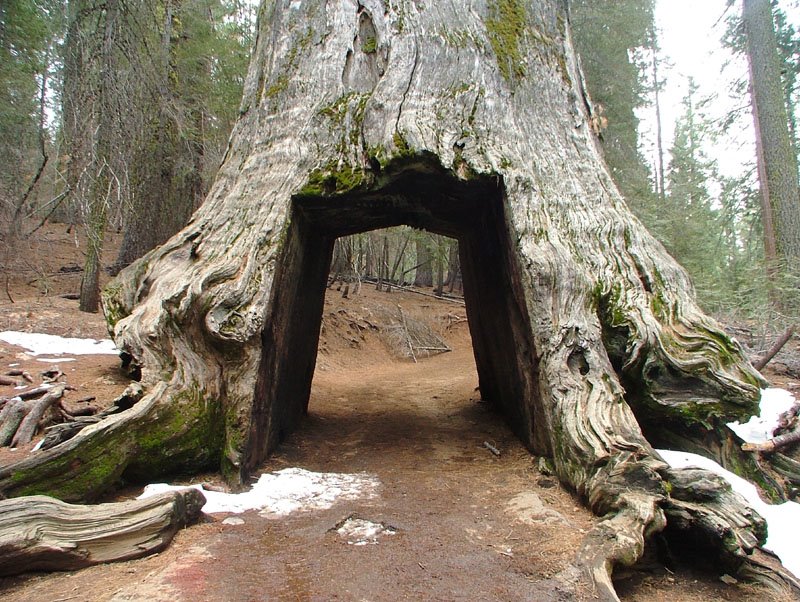
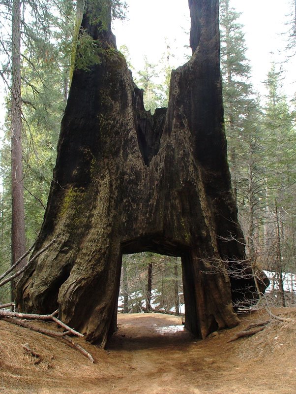
Below is an old dead Giant Sequoia that cars used to drive through in the old days. Its top broke out long ago but, as you can see, the rest of it is still quite impressive.


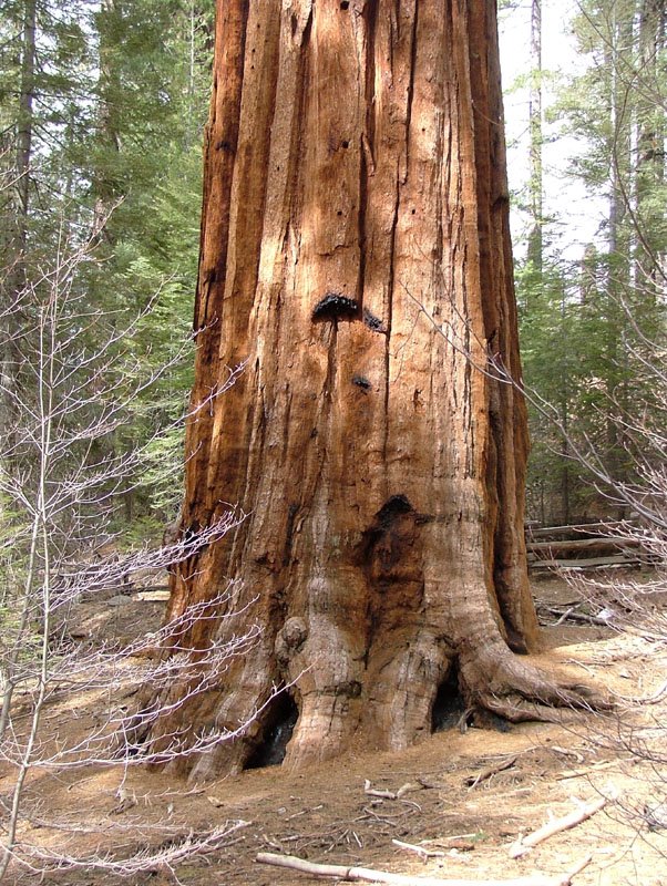
The sheer massiveness of these giants does take your breath away. They sure don't taper much as they reach for the sky, either. I just love that cinnamon-colored bark, too.


Here's that tunnel tree again, from the other side. Those two prongs stick up another 35 feet into the air but, I didn't see any of the rest of the tree on the ground. I'm guessing that it burned up in a fire at some point. That tunnel is about nine feet high, just to give you a frame of reference.


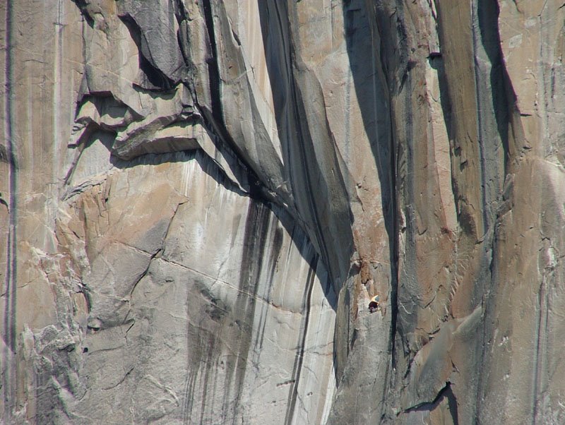
Earlier in the day, before the clouds came in, I tried stopping at my secret Merced River reflection spot, opposite the famous climbers Mecca of El Capitan. I couldn't seem to find many worthwhile shots before looking up and seeing this tiny little climber's bivouac hanging about a third of the way up. You're going to have to look closely to even see it! Right click on the picture, select "Open in a new window" and look at about 5 o'clock from the center of the picture. Why they were trying to climb this 3000 foot cliff in mid-March, I don't know. An old roommate of mine, years ago, got snowed off El Cap and had an epic tale to tell. Even zooming in as far as my powerful 10X zoom would go could not make that bivouac shelter any bigger. One of these days, I'll zoom in and crop out a new picture.


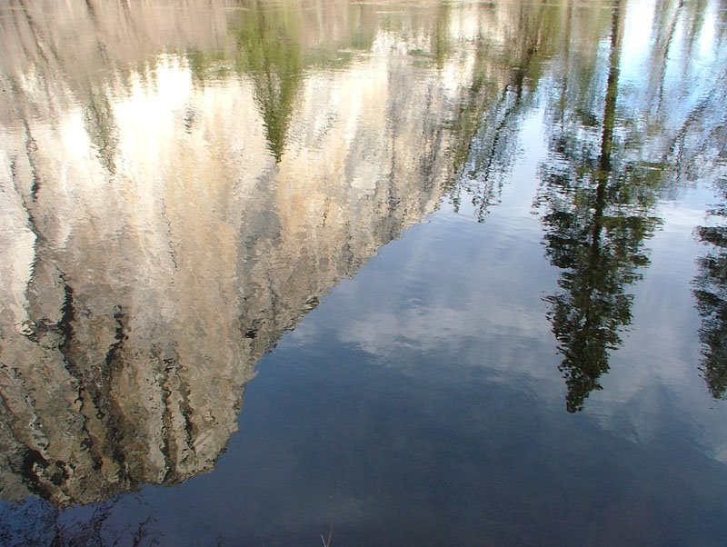
Finally, here's what the Merced River gave me as far as a reflection goes. With the warm temperatures, the river had a little more water in it than the previous times I was there. It's almost like a "natural abstract".


I go back to work on April 1st, and after a weeklong meeting in Reno, I'll be headed up to the Rogue River National Forest, along the southwest coast of Oregon, to inventory and measure trees for thinning projects planned. It's gonna be WET!!

Labels: , ,

Saturday, March 17, 2007

Mix n Match scan batch

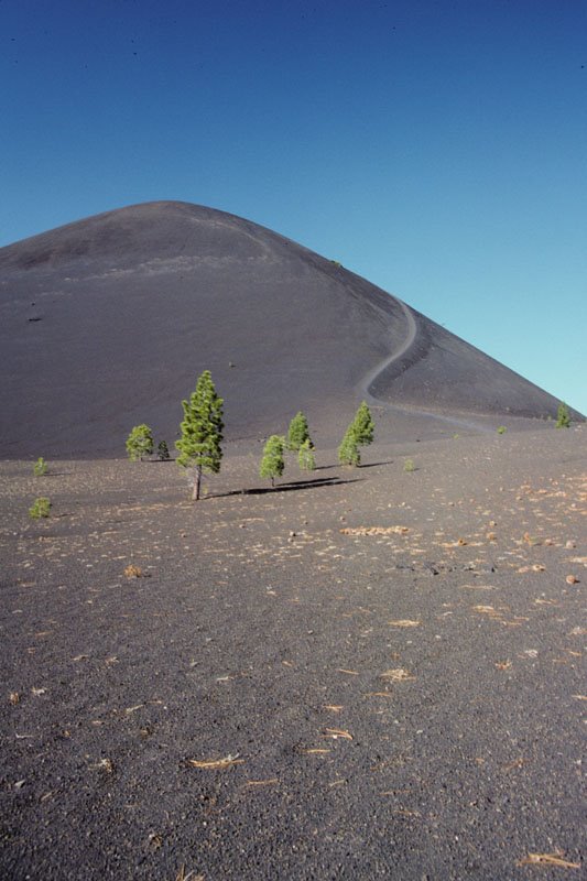
This picture kind of looks out of place in my blog. This is the Cinder Cone from near Butte Lake in the northeast part of Lassen Volcanic National Park. Even though there hasn't been an eruption here in the last 100 years, it's amazing that so little has grown back since then. Even Mt. St. Helens has grown back much more than this.

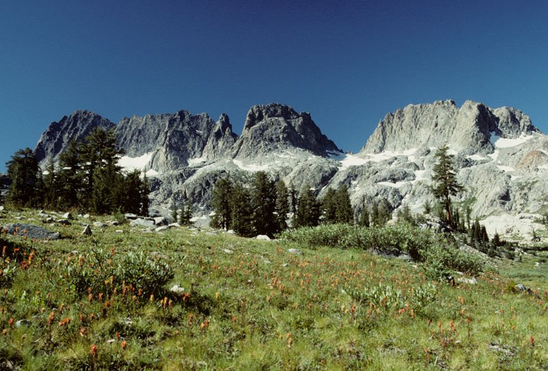
This next picture below is from the Minarets Wilderness, southeast of Yosemite National Park. Also, this is yet another example of my friend Euell's power in providing me perfect conditions for picture taking. This rugged wilderness is definitely one of my very favorite places to get away from the everyday world.


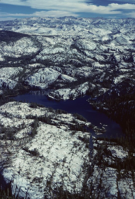
This aerial photo always takes my breath away. I went for a flight with a workmate back in '89 and we flew from Placerville, in California, to Yosemite and then back. Taking this picture through the cockpit window made it a little less than sharp but, I gave it a little sharpening after I scanned it. The northern part of Yosemite National Park is a rugged place, as you can see, and not many people make it out into all that glacier-polished nirvana.


This long exposure of Vidae Falls, in Crater Lake National Park, turned out pretty nice. There's still plenty more of the park for me to discover and photograph. Maybe I'll return there on my trip up to my Mom's in July, like I've done many times in the past.


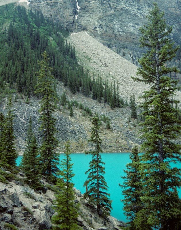
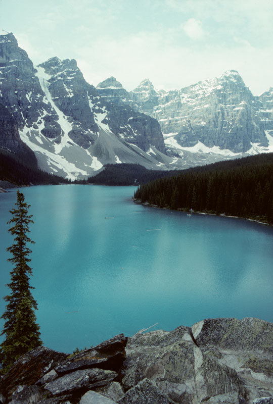
Finally, I came up with another pic of Moraine Lake, in the Canadian Rockies. I sure didn't spend enough time there to properly "capture" everything I wanted to. During that trip, there was lots of rain and I managed to squeeze in quite a few pictures between storms. I wasn't so lucky a few days later in Glacier National Park, though.


Labels: , , , , , , , ,

Friday, February 23, 2007

Fresh scans!

This first one is yet another of my friend Euell's and myself's excursions. We climbed alongside a roaring Horsetail Falls in Desolation Wilderness to get this view of Pyramid Peak.


Moraine Lake in the Alberta Rockies, near Lake Louise, just HAS to be one of the most picturesque places in the world. The lighting conditions there weren't too good but, I had to make do with what natures provided me with. I've been trying a little bit of "tweakage" on my scans to see just what I can and can't do. This one I just couldn't seem to improve that sunny peak enough to make a difference.


Now, here's a picture that never needed any "tweaking". This view of the Sierra Nevada and the Owens Valley from high in the White Mountains is dramatic and, again, is an example of the "Third's Rule". One of these days, I'll post a picture of the next morning's crystal clear view of the entire southern Sierra Nevada.


This part of a slide caught my eye and I wanted to see if I could zoom in and make a new picture of the people on Half Dome's cable ladder. This one you're going to want to right click on the picture and select "Open link in a new window". It was certainly rather intimidating when I first stood here and took this picture.


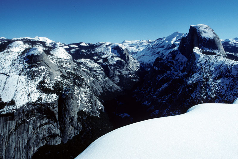
This last shot was a glorious morning back in March of '95. I had just stayed overnight on top of Glacier Point in Yosemite National Park. The fresh snow was still on the trees and the hustle and bustle of everyday life was gone in favor of the wind, the sun, the snow and the sky (and the occasional belching roar of a shuttle bus 3000 feet below).


Labels: , , , , , , , ,

Monday, February 12, 2007

New scanner blasts from the past

Well, the saga of my new Nikon Coolscan V ED came to an surprising end and a bright new beginning. I learned this morning that my new scanner was on a truck and would be delivered today, a full two days early than they had promised. After making backup copies of the software, I proceded to install the scanner's applications and see what this puppy could do.
I've had 40 slides already picked out and I selected the following five to practice on. It seems that I'm going to need the practice, as the scans did not completely capture the vividness of the original Kodachrome slides.
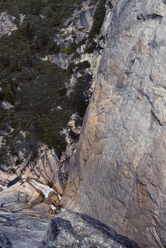
This first one is from sometime during the early 90's, taken at Bear River Canyon on the Eldorado National Forest's Amador Ranger District. I stood on the edge of this huge rugged canyon, teetering on the brink, trying to compose this shot just right. There just was no way to take the shot without standing and looking through the viewfinder at the same time.


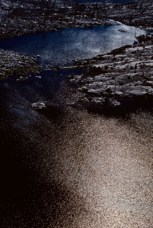
This next picture is also from the Eldorado National Forest in the early 90's but was taken from within the Desolation Wilderness. Twin Lakes is west of Mt Price, which I had climbed earlier that day. Usually, taking pictures into the sun results in exposure problems. Luckily, my subject was not the lake or the land but, the sparkling ripples of the windblown surface. Years ago, when I was in a camera club, this photo earned me a "Picture of the Month".


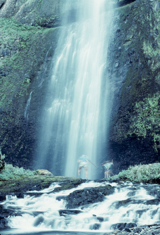
This long exposure of Oregon's Multnomah Falls is even older than the first two pictures. I was experimenting with my then-new tripod and seeing if I could duplicate the smooth water effects of other long exposure photos I had seen before. It took me a bit to set up, right in the middle of the stream but, as soon as I clicked open the shutter, I noticed that there were a father and son in the picture. I sighed, resigning myself to have to wait until they left in order to get a picture with no people in it at this popular tourist attraction. It turned out that this picture is a better storyteller than any of the other shots I took that day.


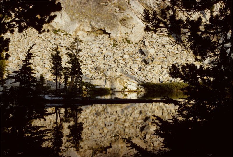
Whenever I go on a mountain trip with my good buddy Euell, I ALWAYS get good conditions and great pictures on those trips. This trip in the early 90's to Yosemite's Grant Lake was a very memorable one. The late afternoon light was electric and the calm of the lake was magical. Alas, the scanner did not capture the vividness of the light reflected off both the rocks and the lake.


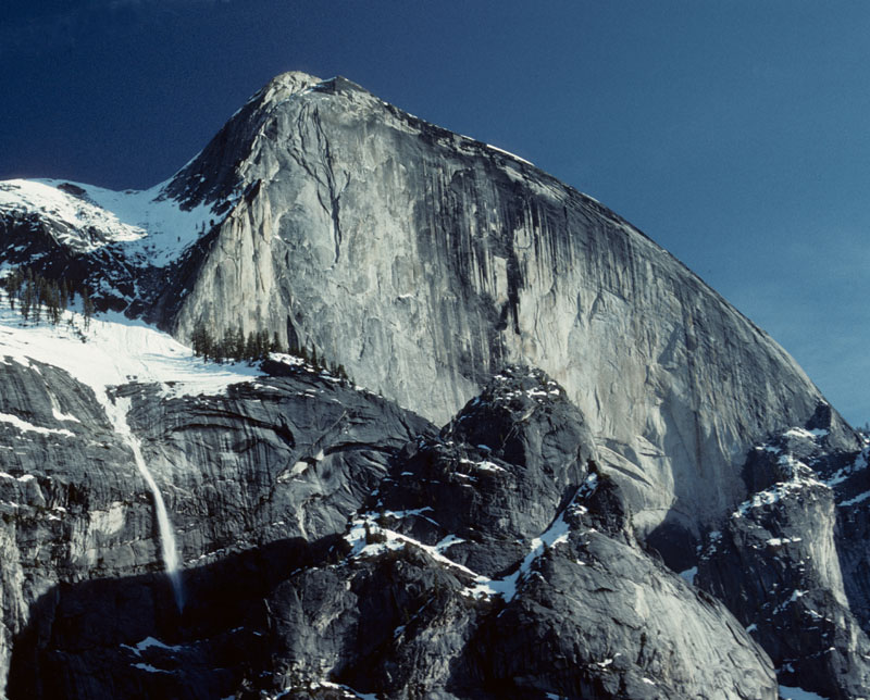
This last picture is one of my treasures. It was again, sometime in the early 90's when I took a hike up the Snow Creek Trail leading out of Tenaya Canyon in Yosemite. The warm spring day was melting snow at a fantastic rate. I had heard and seen (and even captured) snow avalanches during the day. After a full day of climbing up to the snowline, I was on my way back down the trail and stopped for rest and refreshment. I had just loaded my last roll of film and was relaxing in the warm afternoon sun when I heard another rumble. With my camera around my neck, I looked up to see another small avalanche falling alongside the flank of the mighty Half Dome. I grabbed my camera, taking a split second to conciously compose the right shot and then clicked the shutter, hoping I had done everything right.

Yes, it turned out that I had done well with the lighting and the framing of both Half Dome and the avalanche. Unfortunately, there was a jet's contrail across the upper lefthand corner of the picture. In scanning the slide today, I cropped out a majority of it but, couldn't eliminate it completely. I then experimented with trying to digitally remove the rest of it. I used the "clone tool" to paint over the jet trail with the same sky color. Can you tell where it was??


I can tell that I'm going to be having "flashbacks" while scanning photos from my now-distant past. Except for having to clean the dust off all my slides, this is going to be fun!
Labels: , , , , , , ,